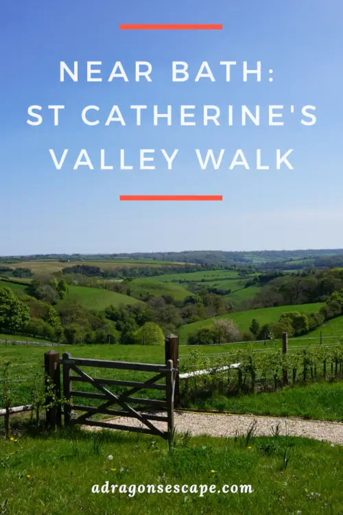
Located near Bath, St Catherine’s Valley is one of the most enchanting and lush valleys in the Cotswolds. The St Catherine’s Valley walk offers a peaceful escape to a hidden valley and the charming hills of the Cotswolds. This circular walk features country paths and rolling fields, and boasts fantastic scenery.
From the quaint village of Cold Ashton to the picturesque hamlet of St Catherine, this Cotswold walk first follows part of the Limestone Link and leads you across the bottom of St Catherine’s Valley. This country walk then climbs steeply to the top of Charmy Down Hill and crosses the disused Charmy Down airfield before heading back to St Catherine’s Valley.
Location: Cold Ashton, South Gloucestershire
Walk difficulty: Intermediate
Time: 4 – 4 ½ hours
Distance: 8 miles (13 km)
Exploring the hidden valley of St Catherine
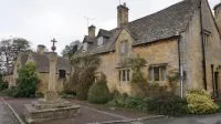
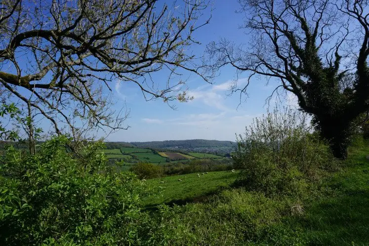
The St Catherine’s Valley walk starts at the quaint village of Cold Ashton, located north of Bath. The Cotswold village offers a charming collection of cottages and converted barns, as well as a 17th century manor. Both the village and the impressive Cotswold manor boast beautiful country views of St Catherine’s Valley.
 Views of St Catherine’s Valley from Cold Ashton
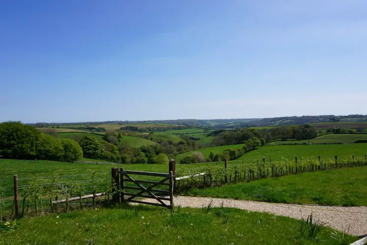
This Cotswold walk first follows part of the Limestone Link, a long-distance path between the Cotswolds and the Mendip Hills. This walk leads you across the bottom of the valley, along country paths and open hillsides, through verdant fields, and past farms and estates. At every twist and turn of the valley, you discover further breathtaking scenery of the rolling Cotswold hills.
You then reach St Catherine’s Brook and follow the bubbling waters into the depths of the valley. As you walk deeper into the secluded and hidden vale, you’re awestruck by the peacefulness and charm of St Catherine’s Valley. This enchanting vale is a true hidden gem to explore and cherish.
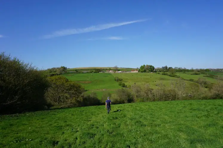
 Strolling across St Catherine’s Valley
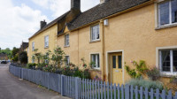
This circular walk then reaches the picturesque hamlet of St Catherine. From the bottom of the valley, you can spot the village on the hillside. Located to the north of Batheaston and Bath, the hamlet of St Catherine features delightful Cotswold cottages, a remarkable 12th century church and an imposing manor house known as St Catherine’s Court.
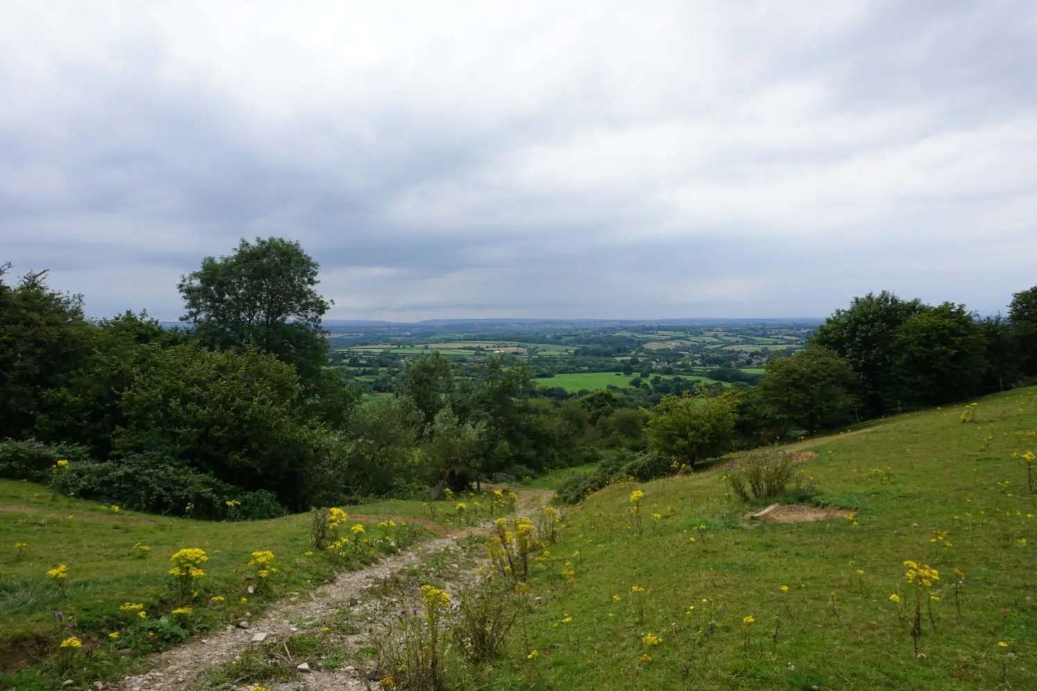
Wandering over the open hilltop of Charmy Down
Shortly after the hamlet of St Catherine, you leave the valley behind and start the steep and strenuous ascent to the hilltop. Hiking along country lanes, you’ll want to stop to catch your breath as well as to discover the breathtaking views of the valley slowly unfolding before your eyes. You can even spot the village of Batheaston in the distance.
 Views of Batheaston
Once you reach the top of the hill, you then follow charming country lanes to the Charmy Down airfield. The airstrip was built during the Second World War to defend Bristol and the South West, and is now abandoned. The runaways and hangers have disappeared and the land is used for farming. This Cotswold walk takes you through the disused airfield, and although you’re at the top of the hill, you can enjoy only limited views of the surrounding countryside.
From Charmy Down, the St Catherine’s Valley walk leads you back to the heart of the valley. The descent isn’t as steep as the ascent, but it is still strenuous. Crossing one verdant field after another, you can even glimpse the village of Cold Ashton across the vale. As you reach the bottom of the valley, you follow the Limestone Link once again and make your way back to Cold Ashton where one final climb awaits.
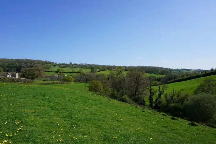
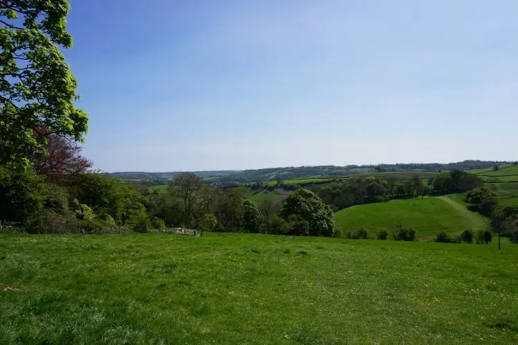
 The descent back to St Catherine’s Valley
St Catherine’s Valley walk itinerary
1. From Cold Ashton’s Parish Hall car park, turn left onto the road. Walk past Cold Ashton manor and at the Old Rectory, turn right and go through the gate into the field, following the footpath sign and the Limestone Link sticker.
2. Continue straight down the field to the kissing gate under the tall tree. Go through the gate and continue straight down. Turn left onto the dirt track and follow the track to the end of the field. Go through the kissing gate, turn right and follow the uphill path.
3. At the yellow signpost, turn sharply left onto the man-made path. Go through the kissing gate and continue straight ahead. Go through the next kissing gate under the trees and continue straight ahead, following the man-made path.
4. Veer right along the hillside, aiming for the left of the tall tree and go through the kissing gate. Follow the path, go through the following gate and continue up the uphill path. Turn left onto the road and then immediately left again, following the footpath sign. Cross over the stile and continue straight ahead, following the downhill path.
5. Go through the gate and cross over the dirt track. Following the signs for the Limestone Link, go through the kissing gate and continue straight ahead. Go through a series of gates and cross a series of fields, following the man-made paths and keeping the field boundaries and the brook to your right.
6. Go through the gate and turn left onto the uphill country road. Turn right at the footpath sign and follow the path. Cross over the stile, the brook and the second stile, and continue straight ahead. At the yellow signpost, veer right towards the bottom of the valley and then keep the fence and the brook to your right.
7. Cross over the stile and continue straight ahead, walking under the pylons. Go through the gate and continue straight ahead. Here, you can spot the hamlet of St Catherine to your right. Cross over the bridge and the stile, and turn right onto the path and into the field, keeping the brook to your right. Go through the kissing gate and continue straight ahead onto the country road.
8. Cross over the bridge and into the courtyard and follow the uphill path between the houses. Go through the gate and turn left onto the road. At the footpath sign level with Hill Barn, turn right onto the uphill track.
Alternate route if the uphill path between the houses is a bog: At the bridge, veer left and continue along the Limestone Link trail. Cross the track, go through a series of gates and cross a series of fields, keeping the fence and the brook to your right. Go through the gate onto the road and turn right. At the junction, turn right and at the footpath sign level with Hill Barn, turn left onto the uphill track.
 Following the Limestone Link
9. At the top of the steep path, turn left onto the dirt track, then sharp right onto another track. Go through the gate and follow the path. At the junction, turn left and continue along the path. Cross over two stiles and at the second stile, turn left and keep the airfield boundary to your left.
10. At the second junction level with the commemorative stone, turn right onto the track and cut across the airfield. At the crossroads, continue straight ahead and go through the gate. When the track veers left, continue straight ahead to the kissing gate (Beware of the electric wire fence).
11. Go through the kissing gate and cross the field diagonally to the left. At the footpath sign, go through the gate and continue downhill to the bottom of the field, keeping the fence to your left (Do not follow the track). Go through two kissing gates and into the field and veer right downhill, keeping the field boundary to your right.
12. Go through the kissing gate and follow the path to the stile. Cross over the stile and turn left onto the road. After the stone wall, turn right, go through the kissing gate and cross the field diagonally to the left, aiming for the middle of the bottom fence. Cross over two stiles and a bridge and turn left back onto the Limestone Link trail.
13. Go through the kissing gate, cross the road and go through the gate, following the signs for the Limestone Link. Continue straight ahead to the crest of the field, cross over the stile and turn right onto the road. Turn immediately right onto the downhill path, cross over the stile and continue straight ahead, following the path.
14. Go through the kissing gate and veer right following the man-made path. At the tall tree, veer left and continue along the hillside. Continue uphill, keeping the trees and the field boundary to your right. At the end of the field, go through the kissing gate and continue straight ahead.
15. Go through the next kissing gate, continue straight ahead then turn sharply right onto the path. Go through the following kissing gate and continue straight ahead. At the yellow signpost, veer right up the hill. Go through the kissing gate and continue straight ahead up the hill. Go through the gate, turn left onto the road and follow the road back to the car park.
Download the walk itinerary PDF: St Catherine’s Valley walk by adragonsescape.com
Find the walk map and download the GPX file: St Catherine’s Valley walk on outdooractive.com
St Catherine’s Valley walk details
Location: Cold Ashton, South Gloucestershire
Walk difficulty: Intermediate
Time: 4 – 4 ½ hours
Distance: 8 miles (13 km)
Ascent: Very steep
Trail condition: Good, but the trail can get muddy in wet weather
Accessibility: Not suitable for pushchairs, wheelchairs or bikes
Parking: Cold Ashton Parish Hall car park (SN14 8JT)
Facilities: Toilets, shops and pubs along the Bath Road (A46)
Notes: Please be mindful of livestock and keep your dogs on a lead. Please beware of oncoming vehicles when walking on roads.
Explore more: Cotswold walks near Bath
The beautiful Cotswold countryside surrounding Bath offers rolling hills, enchanting valleys, lush woodland and splendid scenery. From the Bath Skyline walk to the Dyrham to Doyton walk, the Cotswolds Hills are a delight to explore on foot. Find walks in and around Bath.
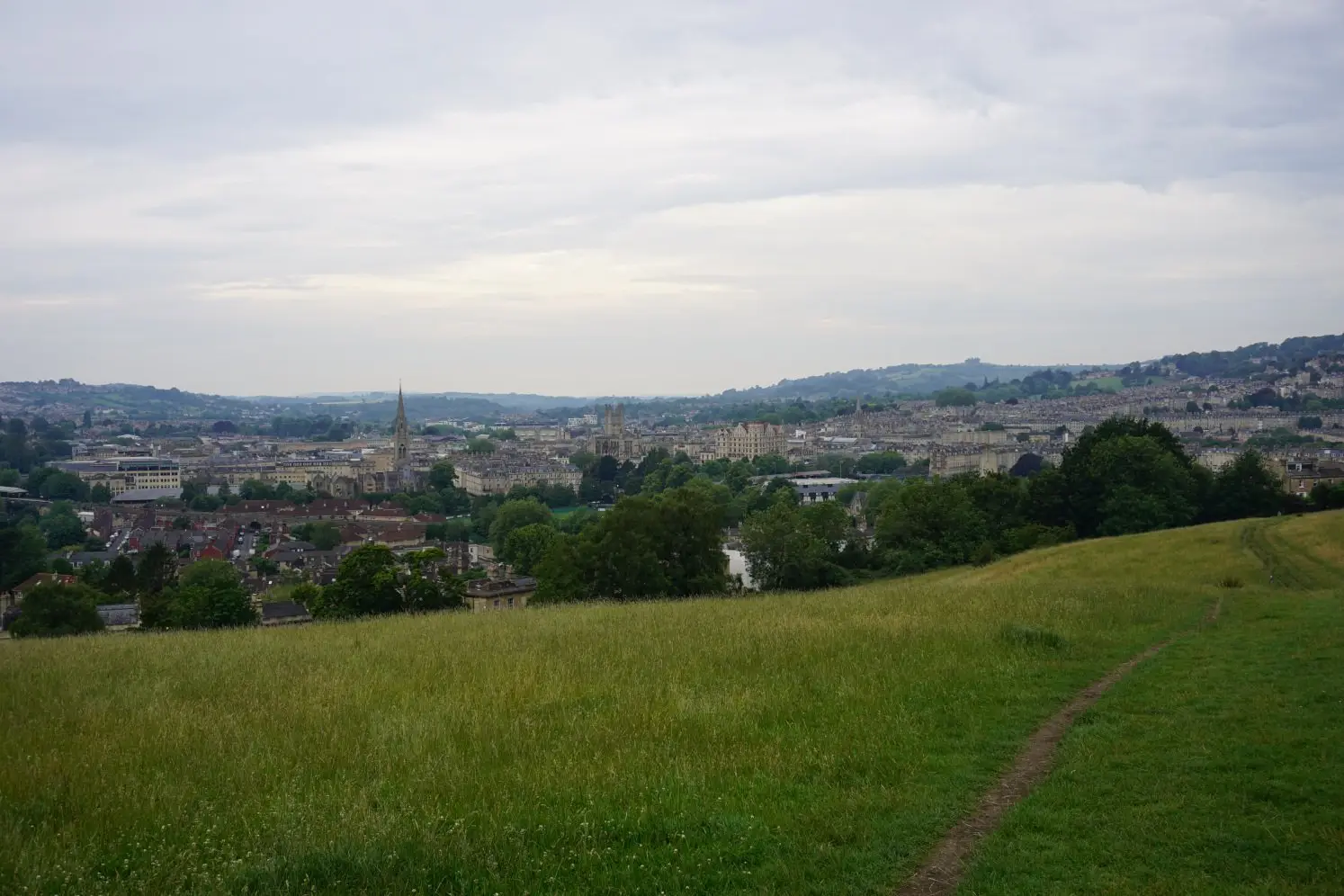 Views of Bath from Bathwick Meadow
Share this guide:
Pin this for later: