Located in the Brecon Beacons, the Capel-y-ffin to Twmpa walk will take your breath away with its steep climbs and its incredible views. Exploring two northern peaks in the Black Mountains, Rhos Dirion and Twmpa (also known as Lord Hereford’s Knob), this challenging hike offers enchanting valleys, majestic mountains, wild moorland and extraordinary scenery. Throughout this circular walk, you’ll be awestruck by the breathtaking views of the valley of Ewyas, the Brecon Beacons mountains, the Wye Valley, the Herefordshire countryside and beyond.
Starting at the quaint hamlet of Capel-y-ffin, this Brecon Beacons hike first climbs steeply to the top of the wild mountain and follows the heather-clad ridge to the two rocky peaks of Rhos Dirion and Twmpa (or as Lord Hereford’s Knob). This circular walk then leads you along another ridge back to the enchanting valley of Ewyas and the charming hamlet of Capel-y-ffin. Be prepared for inclement and ever-changing weather in the Brecon Beacons.
Location: Capel-y-ffin, Brecon Beacons
Walk difficulty: Challenging
Time: 4 to 4 ½ hours
Distance: 9 miles (14.5 km)
Hiking the wild Brecon Beacons moorland
This Brecon Beacons walk starts at the hamlet of Capel-y-ffin, which in Welsh means ‘the chapel at the border’. Nested in the enchanting valley of Ewyas, Capel-y-ffin is small but full of charm. The quaint hamlet features the picturesque St Mary’s Church, a 19th century monastery (now accommodation), and chocolate-box cottages and farms.
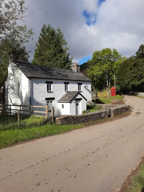
From Capel-y-ffin, this mountain walk first takes you up a country lane, along the bubbling stream of Nant Bwch and up the drive of an equestrian centre. You then start the slow but steep climb up a rocky path. As the track levels off, you reach open grassland and cross the charming stream. From there, you can admire the tall Brecon Beacons mountains and the sheer mountain flank you are about to hike. You can also catch a glimpse of the lush valley of Ewyas.
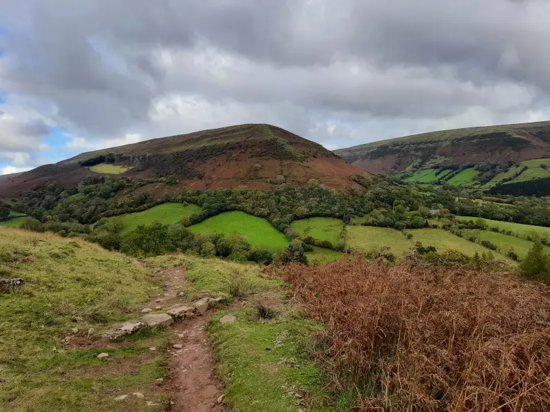
With resolute determination, you start the very steep ascent and zigzag up the mountain flank. In the company of sheep and wild ponies, you stop regularly to catch your breath and to marvel at the views of the enchanting valley unravelling before your eyes. As the path ends, you finally reach the wild, heather-clad moorland typical of the Brecon Beacons.
Climbing the rocky peaks of Rhos Dirion & Twmpa (also known as Lord Hereford’s Knob)
The Capel-y-ffin to Twmpa hike follows the boggy mountain ridge of Ffawyddog. From there, you can enjoy views of the impressive Gryne Fawr Reservoir, which used to supply water to the Welsh region of Monmouthshire. You can also admire the surrounding mountains and the valley of Gryne Fawr. The part of the walk along the ridge is somewhat lengthy. If you start wondering if you’ll ever make it, don’t despair: incredible views are around the corner.
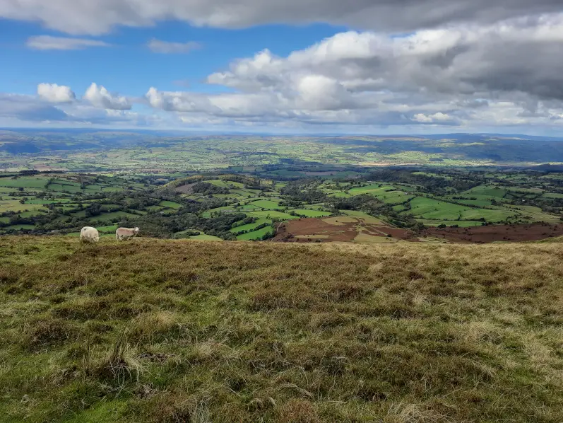
You finally reach the peak of Rhos Dirion which towers at 713 m. From the trig point emblazoned with the Welsh red dragon, you can enjoy incredible views of the snaking river Wye, the rolling Herefordshire countryside and the surrounding Brecon Beacons mountains. Next, this circular walk leads you along another ridge, dipping down into the small valley between Rhos Dirion and Twmpa. All the while, you can marvel at the awe-inspiring scenery.
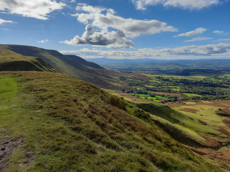
You then start the second (and last) steep climb up the mountain to Twmpa, also known as Lord Hereford’s Knob. There is no trig point to signal this peak, just a cairn towering at 680 m. From Twmpa, you can enjoy further breathtaking views as well as spot the peak of Hay Bluff and the city of Hay-on-Wye.
Exploring the enchanting valley of Ewyas
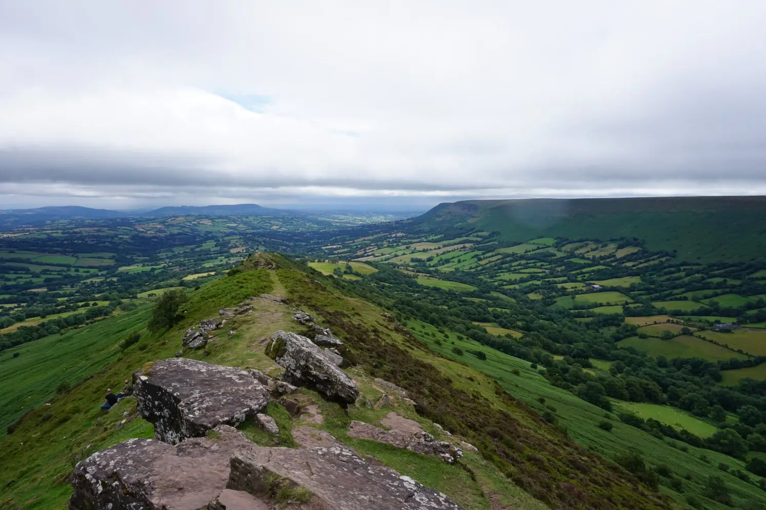
Leaving the peak of Twmpa and its glorious scenery behind, this Brecon Beacons hike takes you along yet another wild, boggy ridge towards the lush valley of Ewyas. The Darren Llywd ridge is set lower than its neighbours and so, you can enjoy lovely views of the surrounding mountains. As you walk along the narrowing ridge, you can also admire the breathtaking valley scenery unfolding before your eyes.
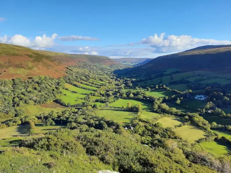
You then start hiking down the steep mountain flank. From there, you can fully marvel at the enchanting valley of Ewyas and the quaint hamlet of Capel-y-ffin. You can spot the 18th century church and the monastery, their white buildings standing out against the backdrop of vibrant green. The Capel-y-ffin to Twmpa walk leads you down a rocky path, through a sea of ferns and along a bubbling stream to the bottom of the valley. You then reach the country road which leads you back to St Mary’s Church and the starting point of this circular walk.
Please note that the paths are very muddy and slippery at times, especially along the mountain ridges and on the last stretch of the descent back into the valley.
Capel-y-ffin to Twmpa walk instructions (with map)
1. At the lay-by on the other side of the bridge from the church, turn left onto the country road before the bridge. Walk up the road and turn left onto the driveway of the equestrian centre. Follow the drive as it veers right and go to the very end. With the house on your right and a gate and caravan straight ahead, follow the uphill path on your left and go through the gate.
2. Follow the rocky path as it zig-zags to the top of the hill, then continue straight ahead. Cross the stream and aim for the clear zigzag path up the mountain flank. Hike the steep zigzag path and follow the track until it reaches the top of the ridge. Turn right and follow the path along the ridge to the end.
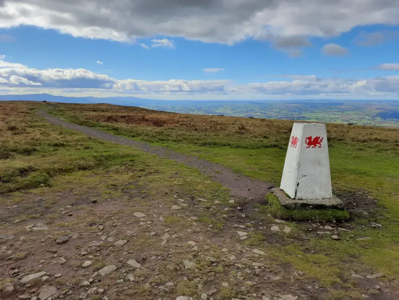
3. At the trig point, you’ve reached Rhos Dirion. Turn right and follow the path along the ridge as it dips down and back up to the peak of Twmpa. Please note that there is no trig point to signal this peak, only a cairn. Turn right and follow the path along the ridge. When the track forks, keep to the left and follow the ridge line.
4. Follow the path as it drops steeply, walk past the cairn and continue straight ahead until it gets too steep and fern blocks your progress. Veer left and follow the path as it zig-zags down the flank of the mountain. Continue straight ahead over the bridleway and down a steep (and muddy) section. Before the enclosed woods, turn left and follow the slippery path along the stream.
5. Go over the stile and cross the farmyard between two houses. Immediately after the houses, go over the stile and cross the field diagonally to the bottom corner. Go over the next stile and turn right onto the country road. Walk past the church, over the bridge and back to the lay-by.
Download the walk itinerary pdf: Capel-y-ffin to Twmpa walk by adragonsescape.com
Find the walk map and download the GPX file: Capel-y-ffin to Twmpa walk on outdooractive.com
Capel-y-ffin to Twmpa walk details
Location: Capel-y-ffin, Brecon Beacons
Walk difficulty: Challenging
Time: 4 to 4 ½ hours
Distance: 9 miles (14.5 km)
Ascent: Very steep
Trail condition: Muddy on certain sections of this walk
Accessibility: Not suitable for pushchairs, wheelchairs or bikes
Parking: Lay-by on the other side of the bridge from the church in Capel-y-ffin (NP7 7NP)
Facilities: Closest toilets, shops and pubs in Llanthony
Notes: Please be mindful of livestock and keep your dogs on a lead
Explore the Brecon Beacons further
The Brecon Beacons are filled with arresting mountains, wild moorlands, shimmering lakes and enchanting waterfalls waiting to be explored. From the Black Hill & Hay Bluff walk to the Horseshoe Ridge hike, find spectacular walks in the Brecon Beacons and discover breathtaking scenery.
Share this guide:
Pin this for later:
![]()

