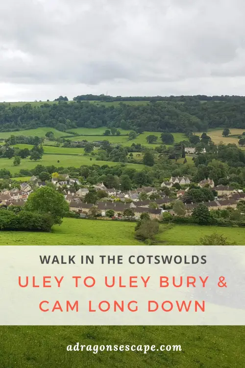
The Cotswolds offer some of the best walks in England. The quaint village of Uley and its enchanting valley and breathtaking hills are no exception. Offering serene country paths, lush woodland and spectacular views, the Uley to Uley Bury and Cam Long Down walk will take your breath away (literally and figuratively).
The short version of this walk takes you from the village of Uley to the hill fort of Uley Bury. The longer version also explores the hills of Cam Long Down and Cam Peak. This circular walk enjoys splendid views of Uley, Dursley, the surrounding valleys, the Cotswold escarpment, the Severn Vale, the Bristol Channel, the Wye Valley and the Brecon Beacons. This country walk includes very steep ascents and descents, and follows part of the Cotswold Way Circular.
Location: Uley, Gloucestershire
Walk difficulty: Intermediate
Time: 1 to 1 ½ hours / 2 ½ to 3 hours
Distance: 3 miles (4.8 km) / 5 miles (8 km)
Short & long version: The quaint Cotswold village of Uley
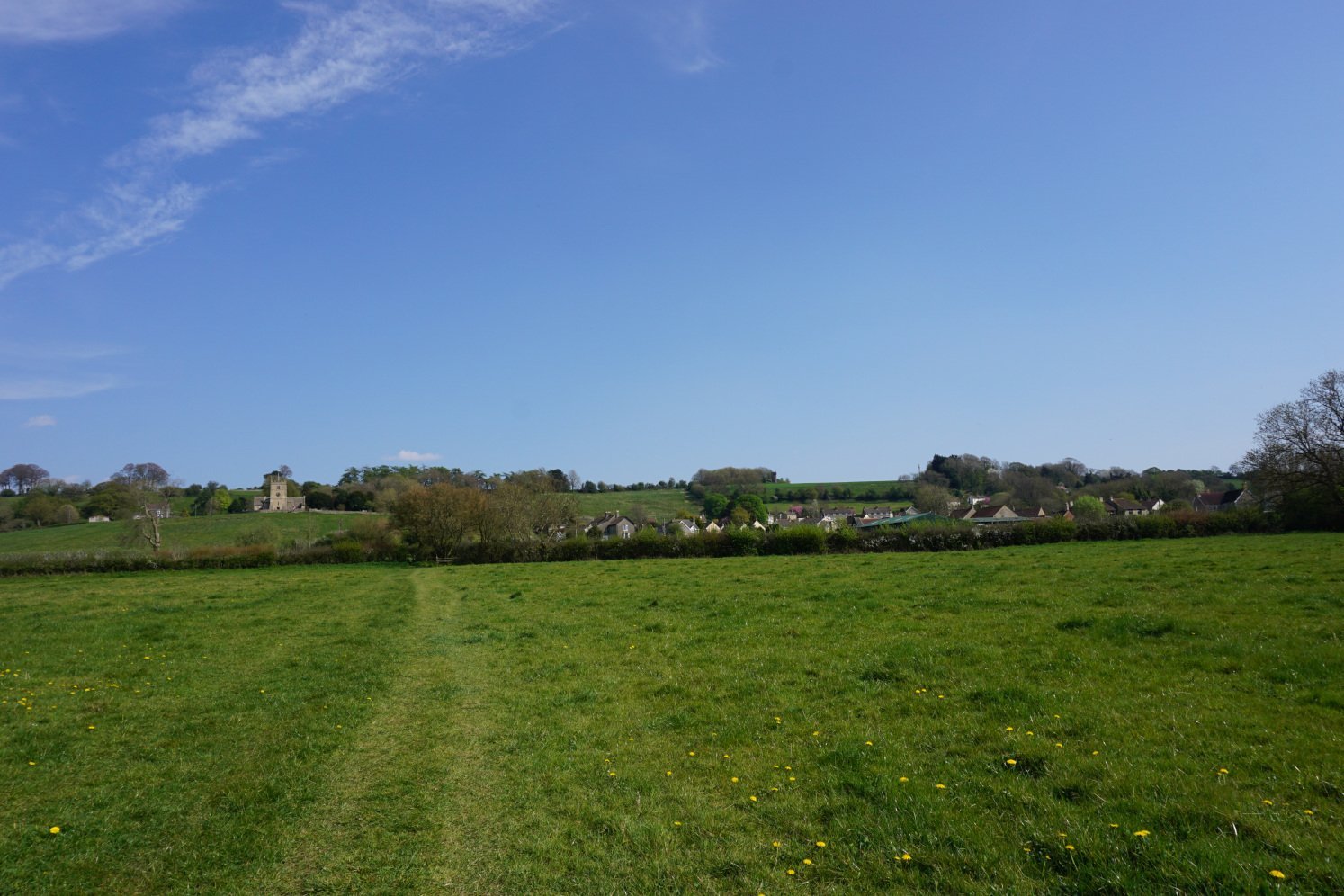
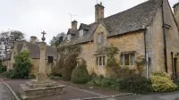
The Uley to Uley Bury and Cam Long Down walk starts at the picturesque village of Uley. A typical Cotswold village, Uley is nested in an enchanting wooded valley in the South Cotswolds. Comprising one main street and a plethora of charming cottages in the distinctive Cotswold stone, Uley is a delight to explore. I would recommend walking up and down the main street to spot your favourite cottages.
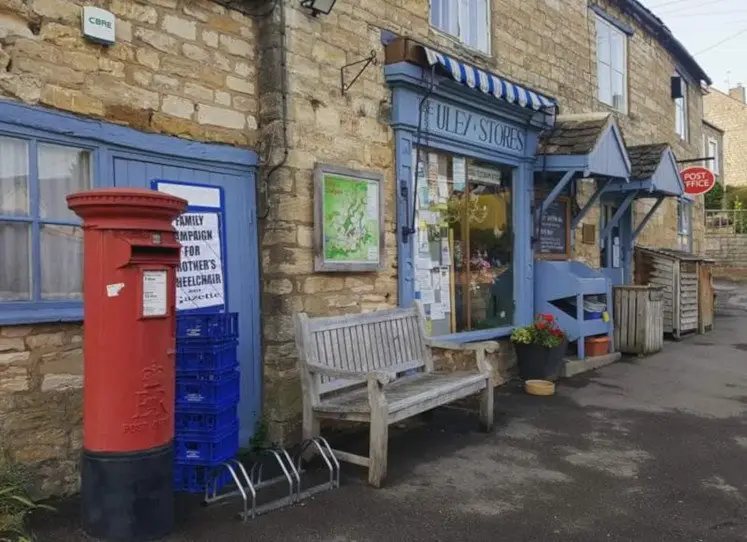 Quaint store in Uley
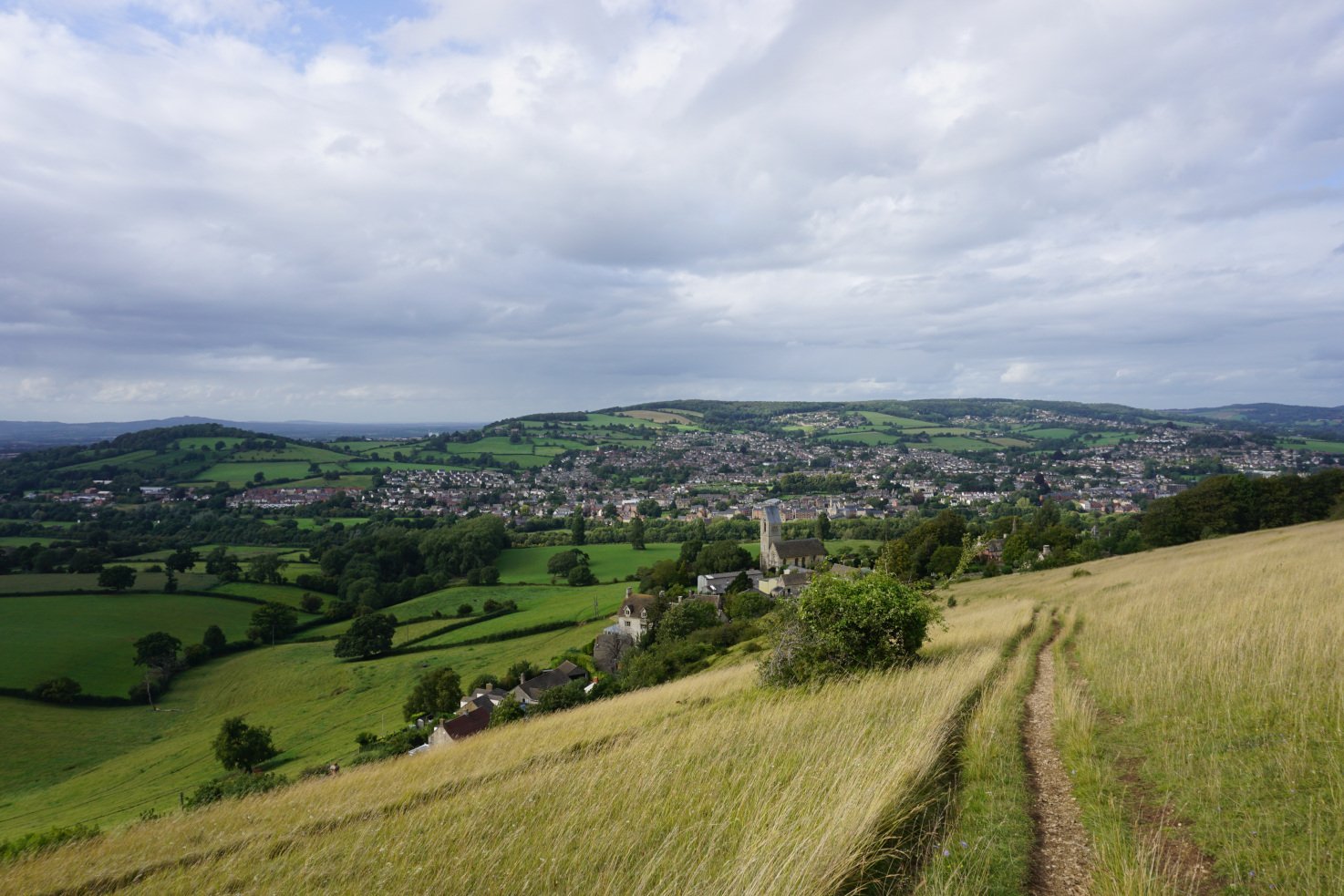
From the quaint village shop, this Cotswold walk leads you along small village lanes towards the medieval church of St Giles. You then start the hike up the hill, crossing a verdant field. As you enter the lush forest, the path gets steeper and your breath gets shorter. You then emerge from the woodland and complete the final climb. From the top of Uley Bury, you can enjoy lovely views of the village and the valley.
Long version only: The breathtaking hills of Cam Long Down & Cam Peak
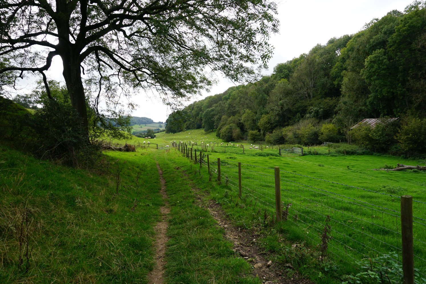
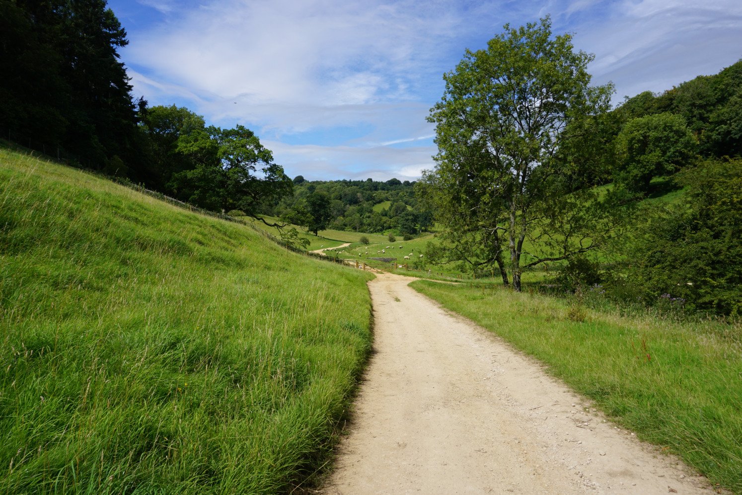
If you’re following the longer version of this walk to Cam Long Down and Cam Peak, this country walk takes you to the edge of the Cotswold escarpment and down the hill through woodland. As you reach the bottom of the valley, you walk along lovely country lanes and up verdant fields. From there, you can admire the surrounding Cotswold countryside as well as the tall hills of Cam Long Down and Cam Peak.
You then start the steep ascent up Cam Long Down, hiking directly up the sheer incline of the hill. When you reach the top of the hill, which stands at 213 meters, you walk along the open ridge. Cut off from the Cotswold escarpment by a valley, Cam Long Down offers amazing 360° views. From the Cotswold Hills to Uley Bury, Cam Peak, Downham Peak, the town of Dursley, the Bristol Channel, the Severn Vale, the Wye Valley and the Brecon Beacons, you’ll be awestruck by the splendid scenery.
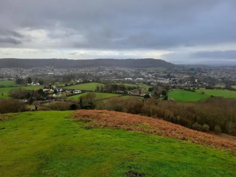 Views from Cam Peak
From Cam Long Down, you then quickly dip down between the two hills before starting your ascent up Cam Peak. Walking up the grassy hillside, you can enjoy further amazing views. You then make your way along country lanes at the bottom of the valley to the foot of Uley Bury. You steel yourself for one last steep climb though woodland to the top of the hill fort. As you climb the hill, you can admire the tall peaks of Cam Long Down and Cam Peak you’ve just climbed.
Short & long version: The stunning hill fort of Uley Bury
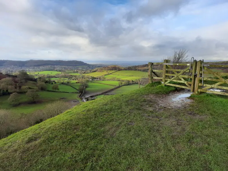
Once you reach the top of Uley Bury, this Cotswold walk leads you round the edge of the hill fort. Uley Bury is an ancient hill fort whose escarpment provided a natural defence during the Iron Age. At the western corner, the fort offers further breathtaking views of the Cotswold escarpment, the Dursley valley, the Severn Vale and beyond.
 Views from Uley Bury
You then continue walking round the edge of the fort and enjoy further fantastic views of the Uley village and valley. From there, this circular walk leads you back down into the valley along a woodland path. The descent is very steep, uncomfortably so. With damp leaves and mud blanketing the path, the trail can be treacherous. When you reach the edge of the woods, you then cross a verdant field and find yourself back on the village lanes and streets of Uley.
Uley to Uley Bury & Cam Long Down walk instructions
1. From the village shop Street in Uley, take the path to the right of the shop. After the last house, turn right onto a woodland path, following the signposts. When you reach the churchyard, turn left onto another path, following the signs for the Cotswold Way.
2. Go through the kissing gate into the field and start uphill veering slightly left. When you reach the trees, turn left onto the man-made path bordering the woods and aim for the top left corner of the field. Go through the gate into the woods and follow the main uphill path. Go through the gate onto an uphill path and when you reach the crest of the hill, veer right along the top.
3. If you’re following the short version of this walk: Go through the gate, turn left and follow the path. Skip to instruction no. 10.
If you’re following the long version of this walk: Go through the gate and turn right onto the woodland path. Go through the next gate and turn left, crossing the edge of the car park. Go through the following gate and turn left onto a downhill woodland path. Following the signposts for the Cotswold Way, keep to the main path.
4. When you reach a farmyard, continue straight ahead along the path. At the road, turn right, still following the signposts. When the road bends, cross over the stile on your left into a field and turn right up the hill, keeping the hedge to your right.
5. Cross over the stile in the top corner and continue straight ahead up the steep hill, following the signposts dotted across the field. Walk up the steps and cross over the stile into the woods. Take the path straight ahead and zig zag up the hill, still following the signposts for the Cotswold Way.
6. When you reach the top of the hill, veer left onto the path and keep to the ridge of the hill. Veer left along the downhill path and keep to the main path, still following the signposts for the Cotswold Way.
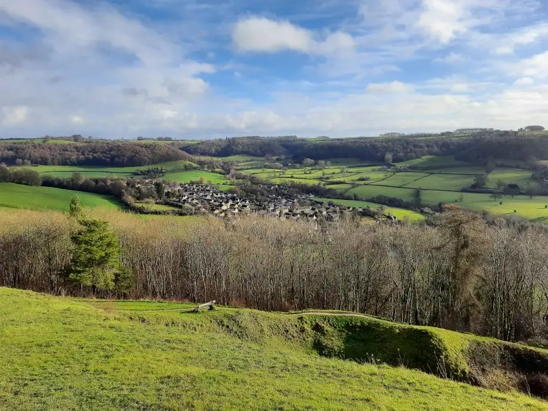 Views of Uley from Uley Bury
7. Walk up another hill to the peak; you’ve reached Cam Peak. Turn around and go back down the hill along the same path. Before you reach the trees, turn right and aim for the farm house and the gate in the hedge. Go through the kissing gate into the field and continue straight down, keeping the hedge to your left and following the signposts for the Cotswold Way.
8. Go through the kissing gate onto the road and leaving the Cotswold Way behind, turn left, then left again up a lane, following the signposts. When the road bends sharply left, turn sharply right along a path between hedges and with a stream. Turn left onto the road and at the intersection, continue straight ahead along the uphill path, following the signposts for the Cotswold Way.
9. Veer right along the woodland path and turn left up the steps, still following the signposts for the Cotswold Way. Cross over the stile and veer left, following the man-made path uphill and the signposts. Cross over two more stiles and turn right onto a path.
10. The short and long version of the walk meet back here: Go through the gate and follow the crest of the hill. At the next corner of the hill, turn right along a downhill path, following the signposts. Continue straight across a path intersection and go through the gate into the woods. Follow the downhill path through the woods.
11. Cross over the stile into the field and continue straight downhill, keeping the fence to your right. When you reach the tarmac path, follow it downhill along the field boundary. In the corner, go through the kissing gate onto a lane. Turn left onto the road and turn left onto the main road, you’ll find your way back to the village shop.
Download the walk itinerary PDF: Uley to Uley Bury & Cam Long Down by adragonsescape.com
Find the walk map and download the GPX file – Long version: Uley to Uley Bury & Cam Long Down walk on outdooractive.com
Find the walk map and download the GPX file – Short version: Uley to Uley Bury walk on outdooractive.com
Uley & Uley Bury walk details
Location: Uley, Gloucestershire
Difficulty: Intermediate
Time: 1 to 1 ½ hours for the short version / 2 ½ to 3 hours for the long version
Distance: 3 miles (4.8 km) for the short version / 5 miles (8 km) for the long version
Ascent: Very steep
Trail condition: Good, but the trail can get muddy and treacherous in wet weather.
Accessibility: Not suitable for pushchairs, wheelchairs or bikes.
Parking: The Street in Uley (GL11 5SL)
Bus: No. 65 from Dursley or Stroud (limited service)
Facilities: Toilets, shops and pubs in Uley
Notes: Please be mindful of livestock and keep your dogs on a lead
Explore more: Walks in the Cotswolds
The Cotswolds countryside features countless walks across stunning valleys, over lush rolling hills and through picturesque villages. From the Coaley Peak to Selsley Common walk to the Wotton-under-Edge to the Tyndale Monument walk, discover dazzling country lanes and striking landscapes with the Cotswold walk guides.
 The Cotswold Way across Selsley Common
Share this guide:
Pin this for later: