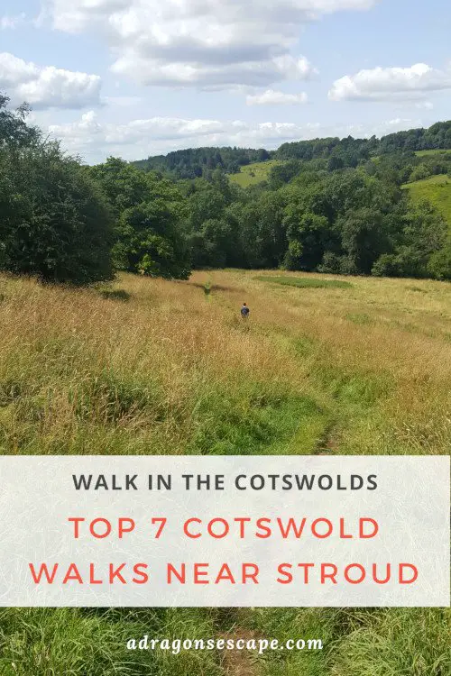
From arresting walks along the Cotswold Way to charming woodland walks and serene canal walks, the Cotswolds cater for every mood and fancy. If you’re looking for a pub walk, a Sunday stroll or an escape to the beautiful countryside, I’ve compiled the 7 best Cotswold walks near Stroud.
The Cotswolds offer many trails across enchanting valleys, over rolling hills and through picturesque villages. From the Painswick Beacon viewpoint walk to the Cotswold Way walk across Selsley Common, all suggested pub walks will let you explore the enchanting scenery of the Cotswolds. Afterwards, you can enjoy well-deserved refreshments at the recommended pubs.
Contents:
1. Painswick Beacon & Painswick Valley walk
2. Bisley-with-Lypiatt walk
3. Coaley Peak & Selsley Common walk
4. Woodchester Park
5. Uley to Uley Bury & Cam Long Down walk
6. Wysis Way in Sapperton
7. Tyley Bottom & Tor Hill walk in Wotton-under-Edge
1. Painswick Beacon & Painswick Valley walk
Best for: Lovely views
Location: Painswick, Gloucestershire
Walk difficulty: Easy
Time: 1 ½ to 2 hours
Distance: 4 miles (9.6 km)
Recommended pub: The Oak in Painswick
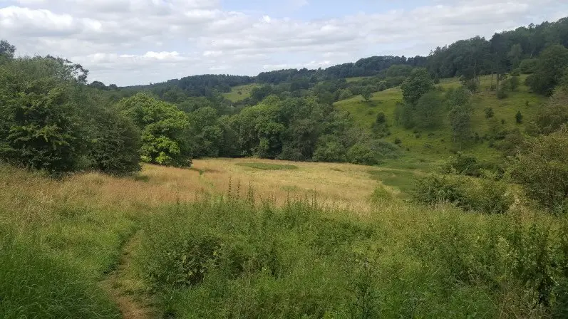
 The valley of Painswick
Located north of Stroud, this Cotswold walk explores the picturesque village of Painswick, the wild common of Painswick Beacon and the charming Painswick Valley. During this circular walk, you’ll enjoy incredible views of the Cotswold Hills, the Severn Vale, the Forest of Dean and the Brecon Beacons.
Leading you along country paths, across lush fields and enchanting valleys, and through lush woodland, the Painswick, Painswick Beacon & Painswick Valley walk follows parts of both the Cotswold Way and the Wysis Way. If you’re after a longer walk, you can combine this pub walk with the Painswick Beacon, Coopers Hill & Painswick Valley walk and wander through lush woodland to the stunning viewpoint of Coopers Hill.
Find the Painswick, Painswick Beacon & Painswick Valley walk guide.
How to get to Painswick
Painswick is a 10-minute drive from Stroud. You can park in the Stamages Lane car park (GL6 6UZ – free for the day at the time of writing). You can also visit Painswick by taking the 66 bus from Stroud (10 minutes). Find the itinerary and timetable for the 66 bus on stagecoachbus.com.
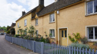
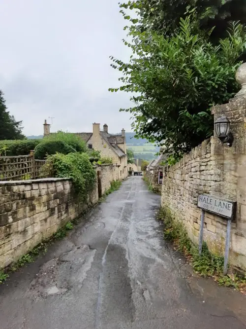 Hale Lane in Painswick
2. Bisley-with-Lypiatt walk
Best for: Country scenery
Location: Bisley, Gloucestershire
Walk difficulty: Challenging
Time: 3 to 3 ½ 3 hours
Distance: 6 miles (9.7 km)
Recommended pub: The Bear Inn in Bisley
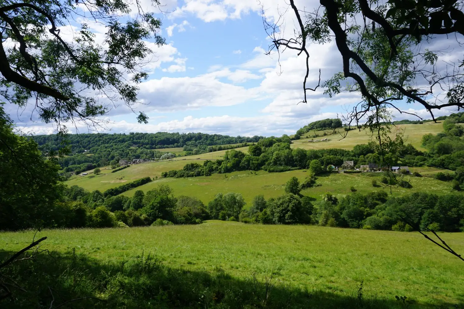 Hidden Cotswold valley near Bisley
From hidden valleys to bountiful hills, lush woods and breathtaking views, the Bisley-with-Lypiatt walk features the best of the Cotswolds. This circular walk is one of the best pub walks near Stroud and offers the perfect country escape to the rolling Cotswold hills. Starting at the quaint village of Bisley, this country walk also lets you discover the town’s picturesque Cotswold cottages.
This Bisley-with-Lypiatt walk is rich and varied, leading you across enchanting valleys and verdant fields, through lush woods and along charming country lanes. Throughout this circular walk, you’ll enjoy striking views of the Cotswold Hills and the Bristol Channel. Back in Bisley, you can indulge in well-deserved refreshments at The Bear Inn.
Find the Bisley-with-Lypiatt walk guide.
How to get to Bisley
You can visit Bisley by car or by bus. Count 10 minutes to drive there from Stroud. You can park in the streets of Bisley, near the Bear Inn (GL6 7BD). You can also take the 8B bus from Stroud (20 minutes). Please note that there are limited services on the 8B bus.
 Country path in Bisley
3. Coaley Peak & Selsley Common walk
Best for: Cotswold Way
Location: Nympsfield & Selsley, Gloucestershire
Walk difficulty: Intermediate
Time: 3 to 3 ½ hours
Distance: 7 miles (11.2 km)
Recommended pub: The Bell Inn in Selsley (15-minute walk from Selsley Common)
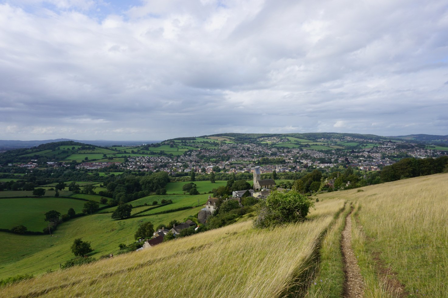
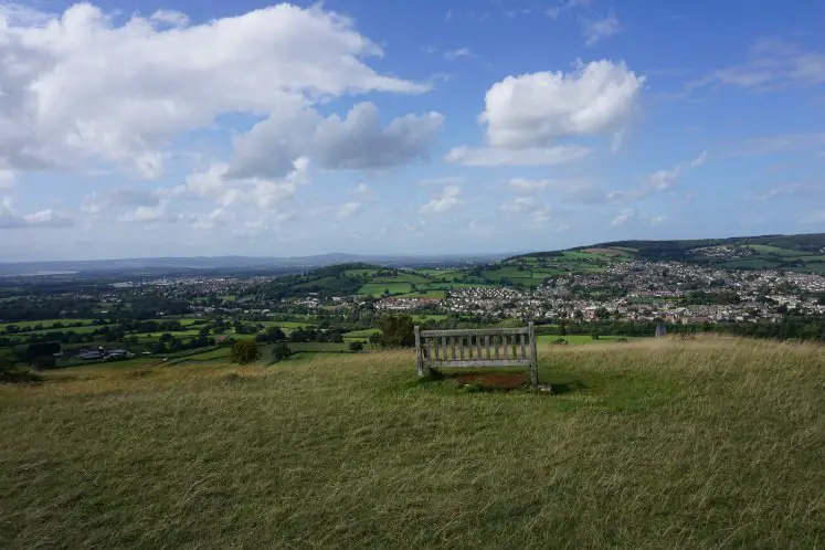 A bench with a view in Selsley Common
The section of the Cotswold Way trail I would recommend exploring near Stroud is from Coaley Peak to Selsley Common. This section offers the best the Cotswold Way has to offer: from stunning viewpoints to peaceful woodland and wild landscapes. You can start this Cotswold walk either at Coaley Peak or Selsley Common. If you wish, you can enjoy a shorter version of this walk and only explore Stanley and Pen Woods or Selsley Common.
Located south of Stroud, the Coaley Peak & Selsley Common walk first explores the Coaley Peak escarpment and its glorious views of the Cotswold hills, the Severn Vale, the Forest of Dean, the Brecon Beacons and Wales. This Cotswold Way walk then escapes to a peaceful woodland and descends to the bottom of an enchanting valley, offering further striking scenery. This pub walk then climbs back up to the Cotswold escarpment and the wild landscape of Selsley Common.
Find the Coaley Peak to Selsley Common walk guide.
How to get to Coaley Peak and Selsley Common
You can travel to Coaley Peak and Selsley Common by car or by bus. Count 10 minutes to drive there from Stroud. You can park in the Coaley Peak car park (GL10 3TP – free of charge at the time of writing) or a Selsley Common lay-by (GL5 5LL – free of charge at the time of writing).
You can also visit Coaley Peak by taking the 65 bus from Stroud to Nympsfield and walk from Nympsfield to Coaley Peak (30 minutes in total). Alternatively, you can take the 66 bus from Stroud to Selsley (5 minutes). Find the itineraries and timetables for the 65 and 66 buses on stagecoachbus.com. Please note that there are limited services on the 65 bus.
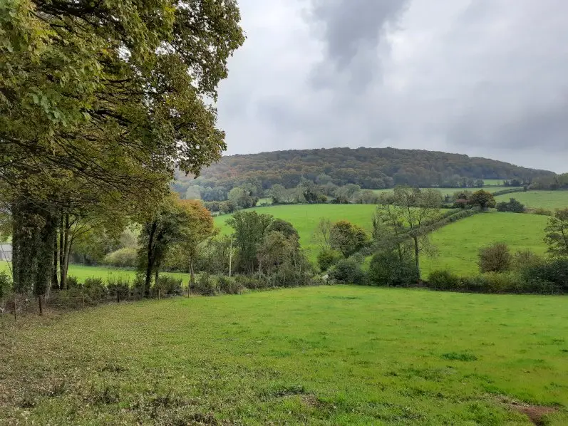
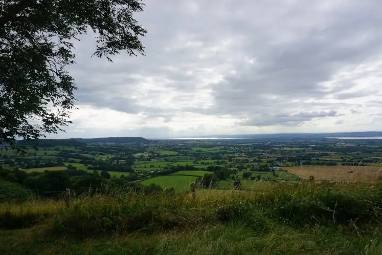 Views from Coaley Peak
4. Woodchester Park
Best for: Woodland
Location: Woodchester Park, Nympsfield, Gloucestershire
Walk difficulty: Easy
Time: 1 to 3 hours depending on the walk trail
Distance: 2 to 7 miles depending on the walk trail
Recommended pub: Rose & Crown in Nympsfield (15-minute walk from Woodchester Park)
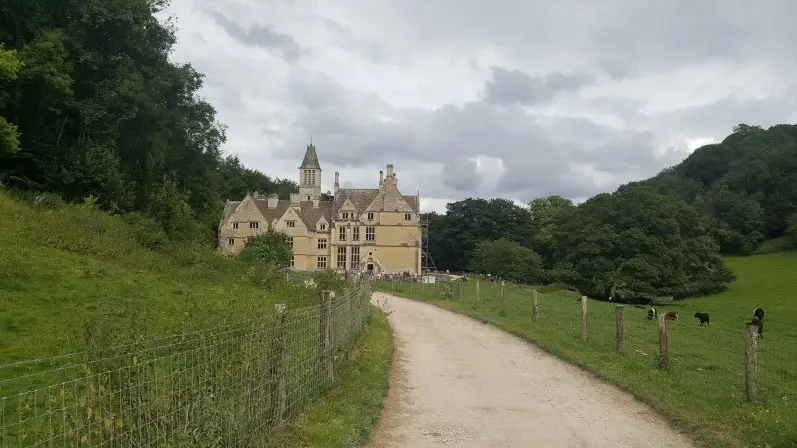
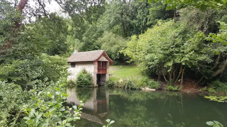 The Boathouse in Woodchester Park
Nested in a wooded Cotswold valley, Woodchester Park offers an enchanting woodland walk near Stroud. The 18th and 19th century landscape park features a majestic but unfinished Victorian mansion, five man-made lakes, a boathouse and lush woods. You can easily imagine the 18th century park as it was back then, with its horse-drawn carriages, leisurely walks, lavish picnics and rowing boat trips.
Woodchester Park boasts many paths through its woodland and pastures, and along its lakes. Walking along the serene paths, you can escape the world and all your worries. You can choose between the different circular walks marked out by the National Trust, ranging from 1 to 3 hours long and 2 to 7 miles long. All you need to do is follow the signposts. Most of the paths are paved, but the trails can get muddy in wet weather. Find out more about Woodchester Park on nationaltrust.org.uk.
 Woochester Mansion in Woodchester Park
How to get to Woodchester Park
You can travel to Woodchester by car or by bus. Count 15 minutes to drive there from Stroud. You can park in the Woodchester Park pay and display car park (GL10 3TS).
You can also visit Woodchester Park by taking the 65 bus from Stroud to Nympsfield and walk from Nympsfield to Woodchester Park (30 minutes in total). Find the itinerary and timetable for the 65 bus on stagecoachbus.com. Please note that there are limited services on the 65 bus.
The entrance to the Woodchester Park is free, but if you drive there, you need to pay for the car park.
5. Uley to Uley Bury & Cam Long Down walk
Best for: Viewpoints
Location: Uley, Gloucestershire
Walk difficulty: Intermediate
Time: 1 to 1 ½ hours or 2 ½ to 3 hours depending on the walk trail
Distance: 3 miles (4.8 km) or 5 miles (8 km) depending on the walk trail
Recommended pub: The Old Crown Inn in Uley
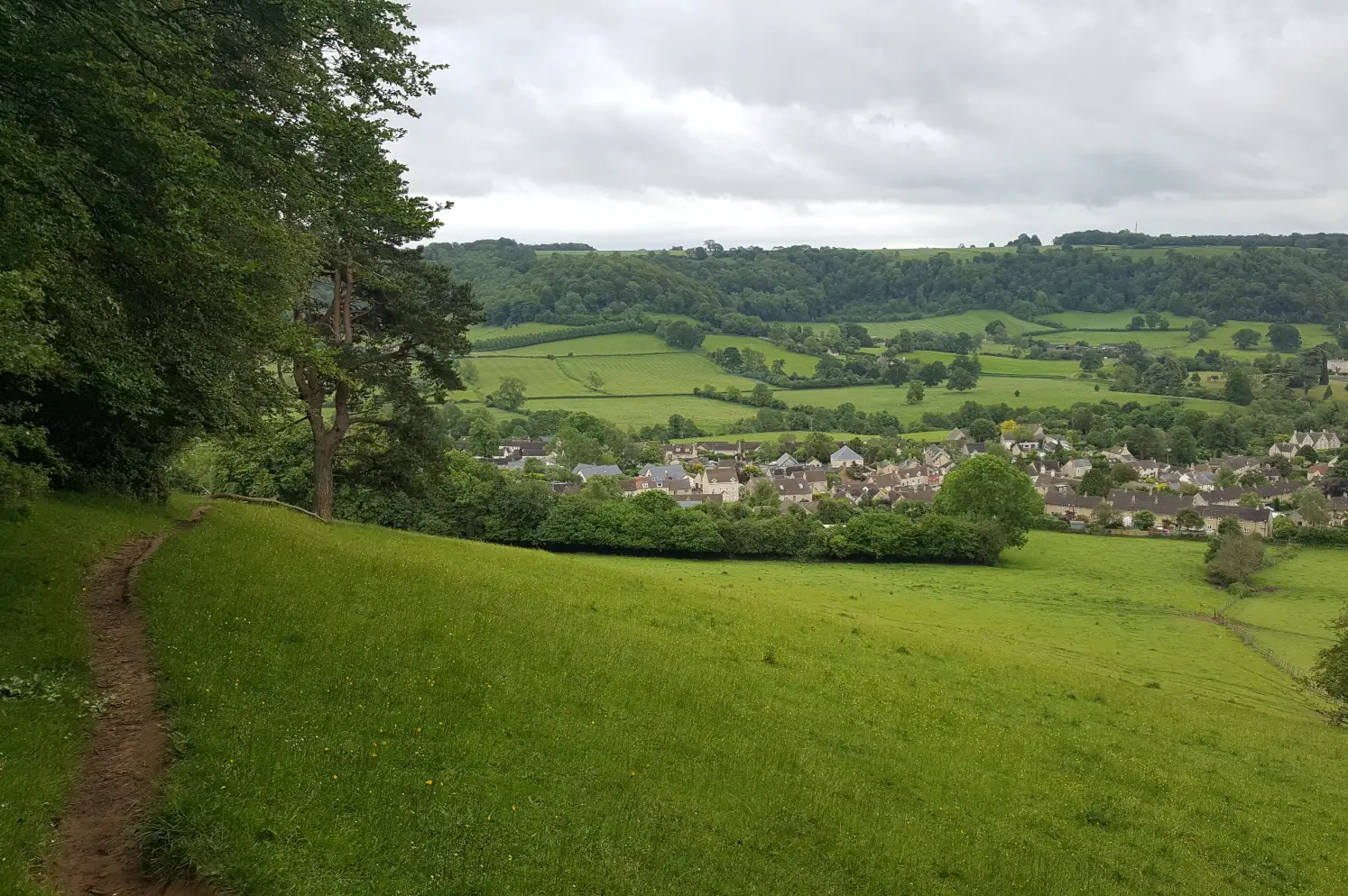 The village of Uley
Another pub walk near Stroud is the Uley to Uley Bury and Cam Long Down walk. Starting at the quaint village of Uley, this Cotswold walk offers serene country paths, lush woodland and spectacular scenery. Throughout this circular walk, you can enjoy breathtaking views of Uley, Dursley, the surrounding valleys, the Cotswold escarpment, the Severn Vale, the Bristol Channel and South Wales.
The short version of this pub walk takes you from the village of Uley to the hill fort of Uley Bury. The longer version also explores the hills of Cam Long Down and Cam Peak. This circular walk includes very steep ascents and descents, and follows part of the Cotswold Way Circular. You can even finish this walk in Uley’s pub, The Old Crown, for well-deserved refreshments.
Find the Uley, Uley Bury and Cam Long Down walk guide.
How to get to Uley
You can travel to Uley by car or by bus. Count 15 minutes to drive there from Stroud. You can park along The Street in Uley (GL11 5SL). You can also visit Uley by taking the 65 bus from Stroud (20 minutes). Find the itinerary and timetable for the 65 bus on stagecoachbus.com. Please note that there are limited services on the 65 bus.
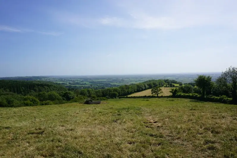
 Views from Uley Bury
6. Wysis Way in Sapperton
Best for: Canal
Location: Sapperton, Gloucestershire
Walk difficulty: Easy
Time: 1 ½ to 2 hours
Distance: 4.4 miles (7 km)
Recommended pub: The Bell in Sapperton
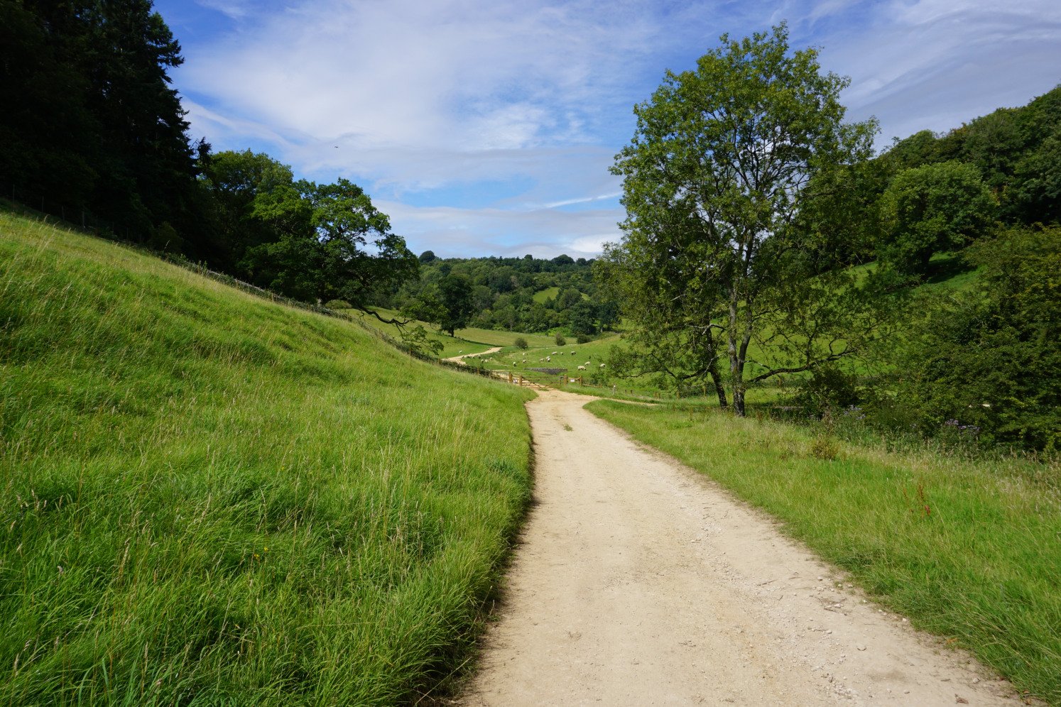
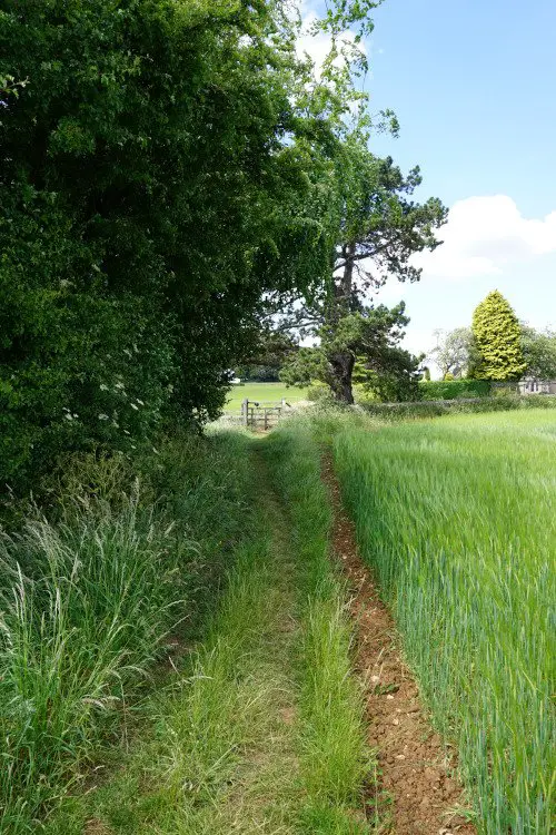
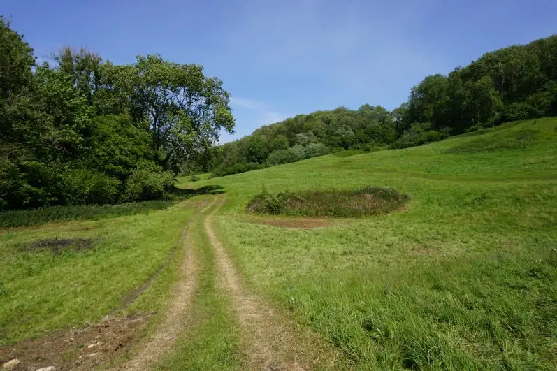
The Wysis Way is a 52-mile-long national trail linking the Forest of Dean to the Cotswolds. The Wysis Way runs north of Stroud into the Chalford Valley. The trail section I would recommend exploring near Stroud is between Sapperton and Frampton Mansell. This section offers a delightful canal walk.
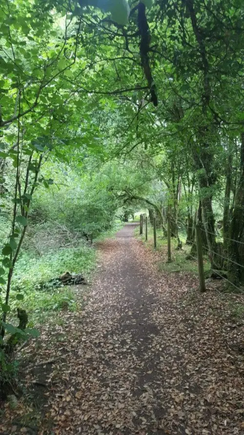 The Wysis Way through Siccaridge Wood
From Sapperton to Frampton Mansell, the Wysis Way follows the old Thames and Severn Canal, now overgrown with water plants. The path leads you along the canal banks and through Siccaridge Wood. Surrounded by serene woodland and catching quick glimpses of green fields, this canal walk near Stroud offers a true escape to enchanting woods.
Wysis Way walk itinerary
This section of the Wysis Way trail starts on Church Lane in Sapperton. Follow the Wysis Way sign down steps and take the small lane to the left of the school. The path will lead you down a field into the woods and along the canal. From there, just follow the signposts and the path. Once you reach the road bridge in Frampton Mansell, walk back to Sapperton the way you came.
On the way back, when you reach the Daneway Inn pub, don’t follow the sign for the Wysis Way and cross the small bridge over the river, but continue straight ahead to the back of the pub car park where the trail continues. The path on this canal walk is mostly paved, but some part of the trail can get muddy in wet weather.
 The Wysis Way in Sapperton
How to get to Sapperton
You can visit Sapperton by car or by bus. Count 15 minutes to drive there from Stroud. You can park in the streets of Sapperton, along Church Lane (GL7 6LQ). You can also take the 54 or 54A bus from Stroud (25 minutes). Please note that there are limited services on the 54 and 54A buses.
7. Tyley Bottom & Tor Hill walk in Wotton-under-Edge
Best for: Valley scenery
Location: Wotton-under-Edge, Gloucestershire
Walk difficulty: Intermediate
Time: 3 to 3 ½ hours
Distance: 6.5 miles (10.5 km)
Recommended pub: The Star Inn in Wotton-under-Edge
 The valley of Tyley Bottom
A tranquil pub walk in and around Wotton-under-Edge, this Cotswold walk explores the charming valley of Tyley Bottom and the breathtaking Tor Hill. This circular walk offers fabulous views of Wotton-under-Edge, Tyley Bottom, the Frome Valley, the Cotswold escarpment, the Bristol Channel and South Wales.
This Cotswold walk near Stroud starts at the quaint market town of Wotton-under-Edge and first takes you along delightful country lanes and woodland paths to the valley of Tyley Bottom. This circular walk then leads you along quiet country roads and tracks to the top of Tor Hill. From there, you cross verdant fields back to Wotton-under-Edge.
Find the Tyley Bottom to Tor Hill in Wotton-under-Edge walk guide.
How to get to Wotton-under-Edge
Wotton-under-Edge is a 25-minute drive from Stroud. You can park in the Potters Pond car park (GL12 7HF – free for the day at the time of writing). You can also visit Wotton-under-Edge by taking the 40 bus from Stroud (40 minutes). Please note that there are limited services on the 40 bus.
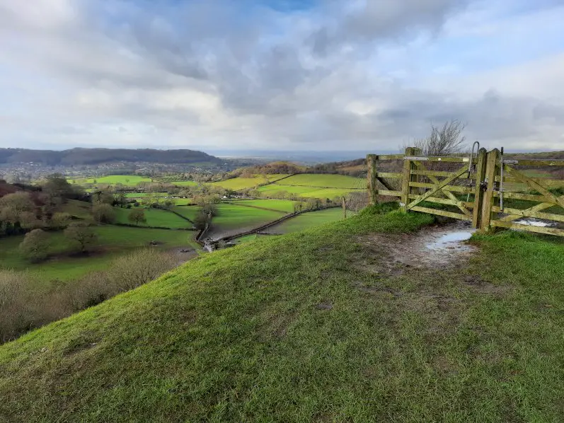
 Views from Tor Hill
Explore more walks in the Cotswolds
The Cotswolds countryside features countless walks across enchanting valleys, over rolling hills and through picturesque villages. From Bath to Broadway and Malmesbury, discover more beautiful country scenery with our Cotswold walk guides.
Share this guide:
Pin this for later: