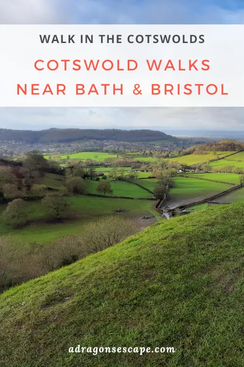
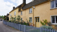
Featuring delightful rolling hills with dry stone wall boundaries, captivating valleys with lush woodland and picturesque villages painted in the distinctive honey-coloured stone, the Cotswolds are a delight to explore on foot. Boasting countless footpaths and enchanting country scenery, the Cotswolds offer the most peaceful escapes and the most charming walks near Bath and Bristol.
1. St Catherine’s Valley walk
Location: Cold Ashton, South Gloucestershire
Walk difficulty: Intermediate
Time: 4 to 4 ½ hours
Distance: 8 miles (13 km)
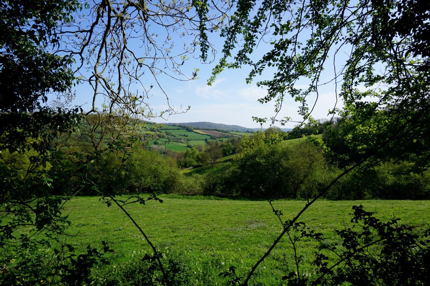
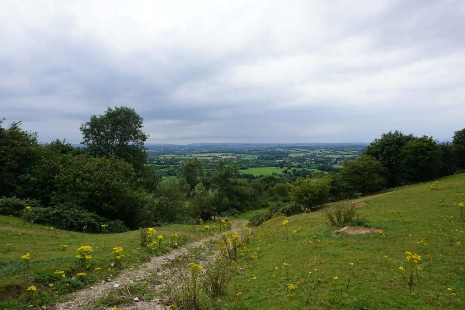
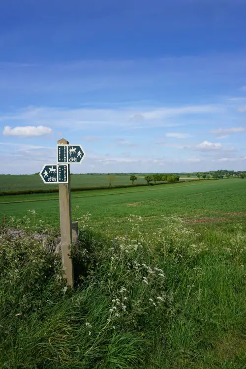
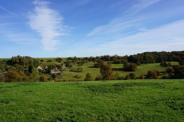
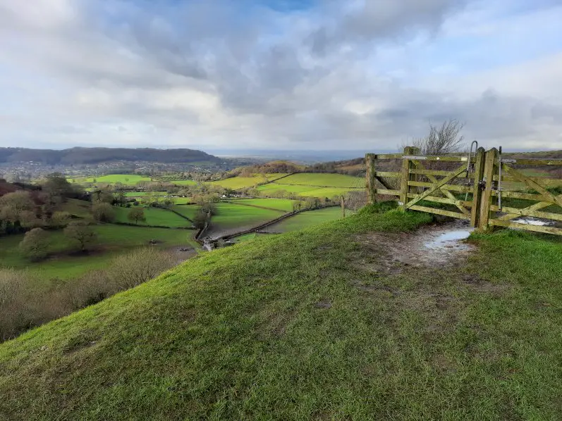
Located near Bath, St Catherine’s Valley is one of the most enchanting valleys in the Cotswolds. The St Catherine’s Valley walk offers a peaceful escape to a hidden valley. At every twist and turn of the vale, you’ll discover the breathtaking scenery of the rolling Cotswold hills.
From the quaint village of Cold Ashton to the picturesque hamlet of St Catherine, this Cotswold walk first follows the bubbling St Catherine’s Brook and leads you across the bottom of St Catherine’s Valley. This circular walk then climbs steeply to the top of Charmy Down Hill and crosses the disused Charmy Down airfield before heading back to St Catherine’s Valley.
Escape to an enchanting valley with the St Catherine’s Valley walk guide.
How to get to Cold Ashton
You can travel to Cold Ashton by car or by bus. Count 15 minutes to drive there from Bath and 25 minutes from Bristol. You can park in the Cold Ashton Parish Hall car park (SN14 8JT). From Bristol, you can also take the 35 bus and get off at the Cold Ashton roundabout (1 hour).
Find the itinerary and timetable for the 35 bus on firstbus.co.uk. Please note that there are limited services on the 35 bus.
2. Badminton walk
Location: Badminton, Gloucestershire
Walk difficulty: Easy
Time: 2 to 2 ½ hours
Distance: 5 miles (8.3 km)
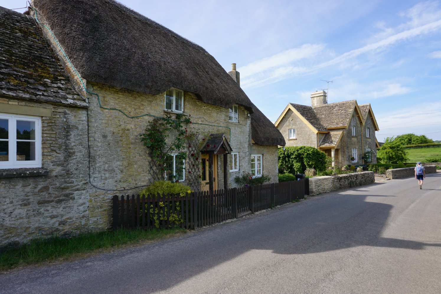
Located north of Bath and east of Bristol, the Badminton walk explores the picturesque Cotswold village of Badminton and the delightful Badminton Park. Featuring quiet country roads, serene woodland and rolling fields, this circular walk enjoys the beautiful scenery of the rolling Cotswold countryside.
Starting at the quaint village itself, the Badminton walk first lets you discover an impressive collection of charming cottages. This Cotswold walk then follows the undulating landscape, before escaping to the otherworldly hamlet of Little Badminton and exploring the tree-lined parkland of Badminton Park.
Explore a picturesque village with the Badminton walk guide.
How to get to Badminton
Badminton is a 30-minute drive from Bath and Bristol. You can park along the village streets. You can also visit Badminton by taking the 620 bus from Bath or the Y1, Y2, Y3, Y4 or Y5 bus from Bristol to Yate Shopping Centre, then the 41 bus from Yate to Badminton (1 ½ hours in total).
Find the itineraries and timetables for the 620 bus on stagecoachbus.com and for the Y1, Y2, Y3, Y4 and Y5 buses on firstbus.co.uk. Please note that there are limited services on the 41 and 620 buses.
3. Alderley & Tresham walk
Location: Alderley, Gloucestershire
Walk difficulty: Easy
Time: 1 ½ to 2 hours
Distance: 4 miles (6.4 km)
Located near Wotton-under-Edge, the Alderley & Tresham walk explores two enchanting valleys and enjoys stunning views of the Cotswold Hills. Strolling across the peaceful valleys, you’ll feel cut off from the rest of the world. This country walk follows parts of both the Cotswold Way and the Monarch’s Way.
This Cotswold walk starts at the quaint village of Alderley and takes you across rolling fields at the bottom of an enchanting valley to the hamlet of Tresham. From there, this circular walk leads you along charming country lanes, across verdant fields and through woodland back to Alderley.
Discover rolling Cotswold hills near Bath and Bristol with the Alderley & Tresham walk guide.
How to get to Alderley
You can travel to Alderley by car or by train and bus. Count 30 minutes to drive there from Bath or Bristol. You can park along the Cotswold Way in Alderley (GL12 7QT). You can also visit Alderley by taking the train from Bath or Bristol to Yate, then the 85 bus from Yate to Alderley (1 ½ hours in total). Alternatively, you can take the 620 bus from Bath or the Y1, Y2, Y3, Y4 or Y5 bus from Bristol to Yate.
Find the itineraries and timetables for the B3 Bristol to Yate train on gwr.com, for the 85 and 620 buses on stagecoachbus.com and for the Y1, Y2, Y3, Y4 and Y5 buses on firstbus.co.uk. Please note that there are limited services on the 85 and 620 buses.
4. Ozleworth & Lasborough walk
Location: Ozleworth, Wotton-under-Edge, Gloucestershire
Walk difficulty: Intermediate
Time: 3 ½ to 4 hours
Distance: 6 miles (9.6 km)
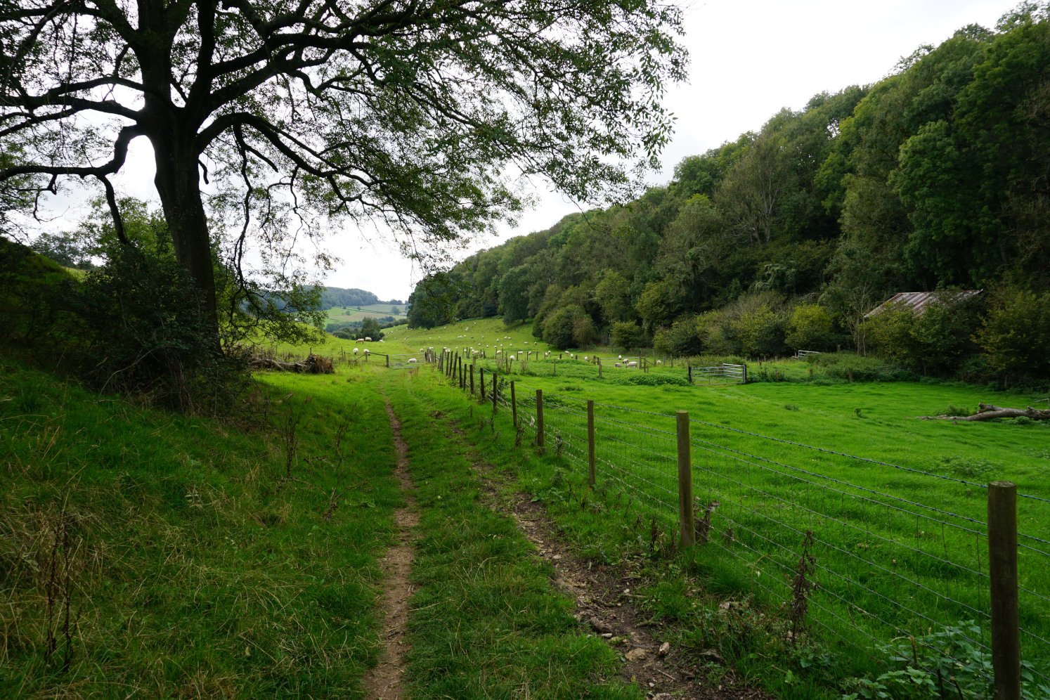
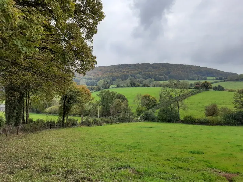
The Ozleworth and Lasborough valleys walk is one of the most charming and peaceful walks near Bath and Bristol. Featuring enchanting valleys, rolling hills and captivating woodland, this Cotswold walk is a true hidden gem. At every step of the walk, you’ll be awestruck by the serene and picturesque rolling hills, and the quaint and secluded valleys.
This Cotswold walk starts at the chocolate-box hamlet of Ozleworth near Wotton-under-Edge. The Ozleworth and Lasborough valley walk first explores the verdant Ozleworth Park before leading you across the quiet Bagpath valley. This circular walk then takes you through the peaceful Lasborough Park and across the wooded Ozleworth Bottom.
Explore hidden valleys with the Ozleworth and Lasbourough valleys walk guide.
How to get to Ozleworth
You can only reach Ozleworth by car. Count a 45-minute drive from Bath or Bristol. You can park in the lay-by on Blacksmith Hill, just outside the northern gate to Ozleworth Park (GL12 7QA).
5. Wotton-under-Edge to the Tyndale Monument walk
Location: Wotton-under-Edge, Gloucestershire
Walk difficulty: Intermediate
Time: 2 to 2 ½ hours
Distance: 5 miles (8 km)
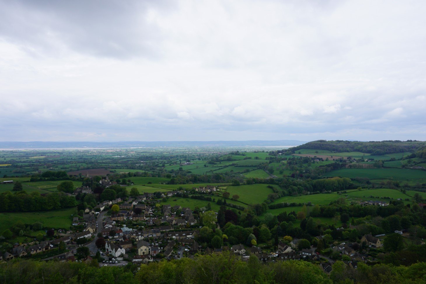
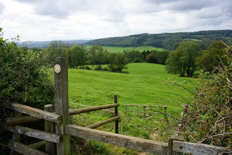
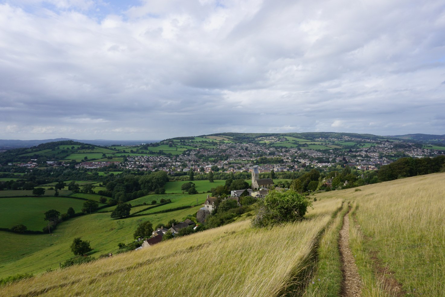
A popular walk from Wotton-under-Edge, this woodland walk follows the Cotswold Way from the market town to the historic Tyndale Monument and lets you discover the Cotswold escarpment. This Wotton-under-Edge walk offers spectacular scenery of the Cotswold Hills, the Frome Valley, the Severn Vale, the Bristol Channel and South Wales.
Located near Bath and Bristol, this Cotswold walk first climbs steeply up Wotton Hill. This country walk then follows the Cotswold escarpment and leads you through the serene woodland of Westridge Woods before reaching North Nibley and the Tyndale Monument. The best views can be enjoyed from both Wotton Hill and the Tyndale Monument.
Discover the Cotswold escarpment with the Wotton-under-Edge to the Tyndale Monument walk guide.
How to get to Wotton-under-Edge
Wotton-under-Edge is a 30 to 40-minute drive from Bath and Bristol. You can park in the Chipping car park (GL12 7BD). You can also visit Wotton-under-Edge by taking the train from Bath or Bristol to Cam & Dursley Railway Station, and then the 60 bus from Cam & Dursley Railway Station to Wotton-under-Edge (1 ½ hours in total). Alternatively, you can take the train from Bath or Bristol to Yate, or the Y1, Y2, Y3, Y4 or Y5 bus from Bristol to Yate, then the 84 or 85 bus from Yate to Wotton-under-Edge (1 ¾ hours in total).
Find the itineraries and timetables for the B3 Bristol to Cam & Dursley train on gwr.com, for the 60, 84 and 85 buses on stagecoachbus.com and for the Y1, Y2, Y3, Y4 and Y5 buses on firstbus.co.uk. Please note that there are limited services on the 60 bus.
6. Uley to Uley Bury & Cam Long Down walk
Location: Uley, Gloucestershire
Walk difficulty: Intermediate
Time: 1 to 1 ½ hours / 2 ½ to 3 hours
Distance: 3 miles (4.8 km) / 5 miles (8 km)
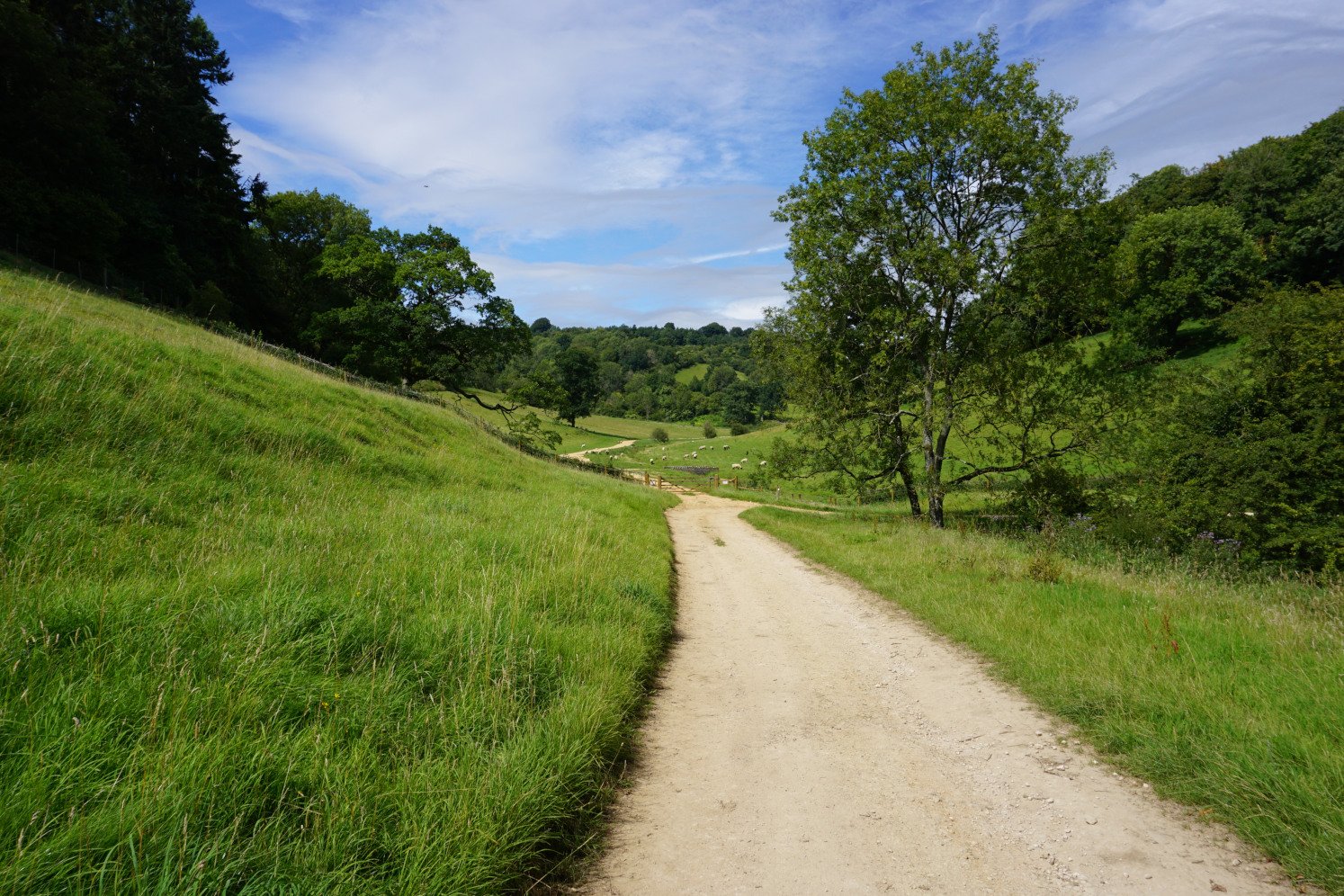
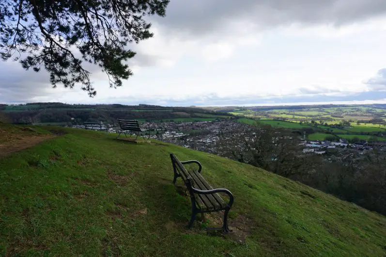
Another top walk near Bath and Bristol is the Uley to Uley Bury and Cam Long Down walk. Starting at the quaint village of Uley near Stroud, this Cotswold walk offers serene country paths, lush woodland and spectacular views. Throughout this walk, you can enjoy breathtaking views of Uley, Dursley, the surrounding valleys, the Cotswold escarpment, the Severn Vale, the Bristol Channel, the Wye Valley and the Brecon Beacons.
The short version of this Cotswold walk takes you from the village of Uley to the hill fort of Uley Bury. The longer version also explores the hills of Cam Long Down and Cam Peak. This circular walk includes very steep ascents and descents, and follows part of the Cotswold Way Circular.
Escape to spectacular scenery with the Uley, Uley Bury and Cam Long Down walk guide.
How to get to Uley
You can travel to Uley by car or by train and bus. Count 40 to 45 minutes to drive there from Bath or Bristol. You can park along The Street in Uley (GL11 5SL). You can also visit Uley by taking the train from Bath or Bristol to Cam & Dursley Railway Station, then the 65 bus from Cam & Dursley Railway Station to Uley (1 ½ hours in total).
Find the itineraries and timetables for the B3 Bristol to Cam & Dursley train on gwr.com and for the 65 bus on stagecoachbus.com. Please note that there are limited services on the 65 bus.
7. Painswick, Painswick Beacon & Painswick Valley walk
Location: Painswick, Gloucestershire
Walk difficulty: Easy
Time: 1 ½ to 2 hours
Distance: 4 miles (9.6 km)
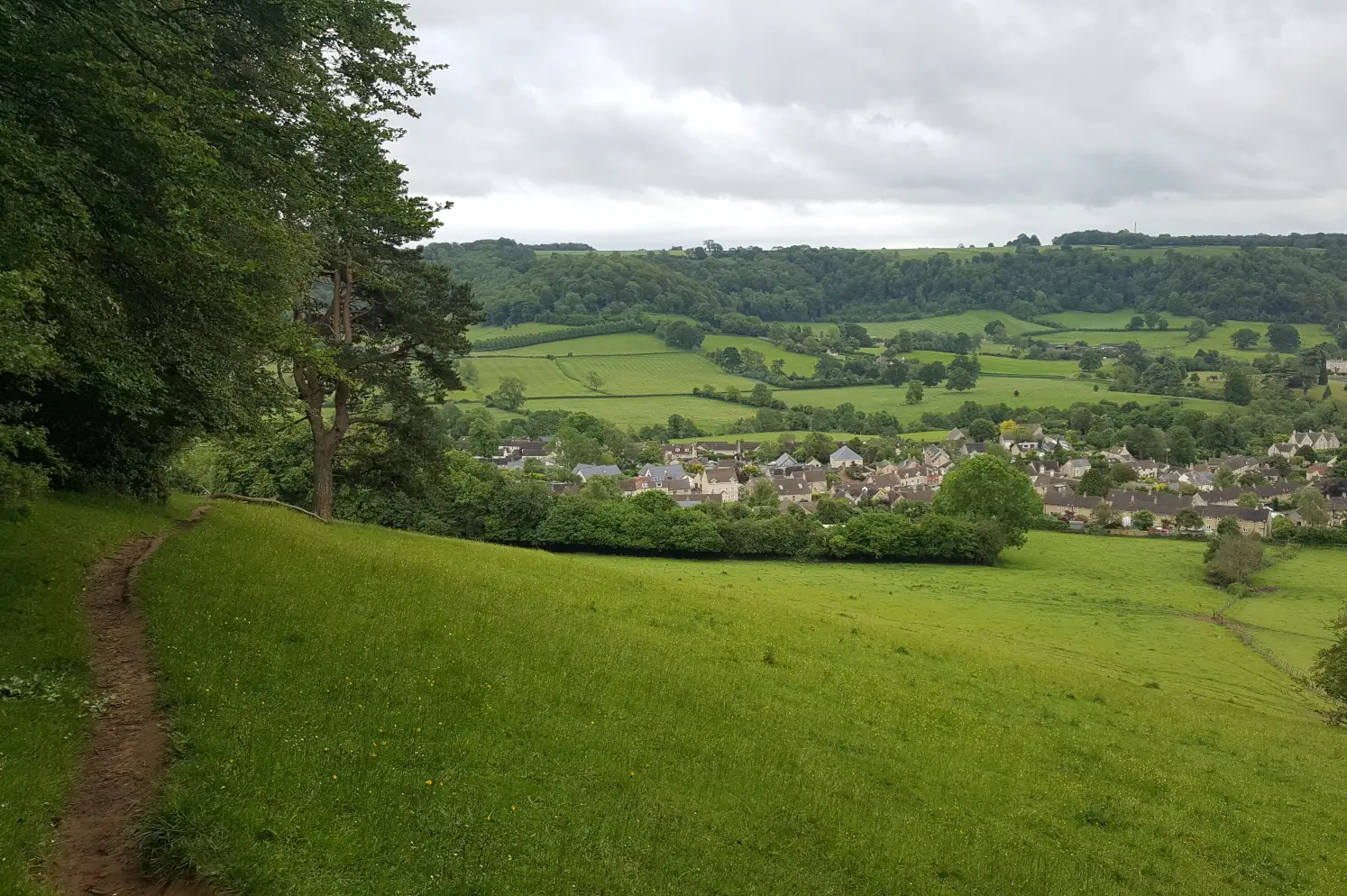
The furthest away from Bath and Bristol, this Cotswold walk explores the picturesque village of Painswick, the wild common of Painswick Beacon and the charming Painswick Valley. During this circular walk, you’ll enjoy incredible views of the Cotswold Hills, the Severn Vale, the Forest of Dean and the Brecon Beacons.
Leading you along country paths, across lush fields and enchanting valleys, and through lush woodland, the Painswick, Painswick Beacon & Painswick Valley walk follows parts of both the Cotswold Way and the Wysis Way. If you’re after a longer walk, you can combine this walk with the Painswick Beacon, Coopers Hill & Painswick Valley walk and wander through lush woodland to the stunning viewpoint of Coopers Hill.
Explore a breathtaking hill and an enchanting valley with the Painswick, Painswick Beacon & Painswick Valley walk guide.
How to get to Painswick
Painswick is a 50-minute to 1-hour drive from Bath and Bristol. You can park in the Stamages Lane car park (GL6 6UZ). You can also visit Painswick by taking the train from Bath or Bristol to Cheltenham, then the 66 bus from Cheltenham to Painswick (1 ¾ to 2 ¼ hours in total). Alternatively, you can take the train from Bath or Bristol to Stroud via Swindon, then the 66 bus from Stroud to Painswick (2 ¼ hours in total).
Find the itineraries and timetables for the B3 Bristol to Cheltenham train, the BL Bristol to Swindon train and the B8 Swindon to Stroud train on gwr.com and for the 66 bus on stagecoachbus.com.
Explore more walks in the Cotswolds
The Cotswolds boast a myriad of rolling hills, enchanting valleys and picturesque villages, and the best way to explore them is on foot. Escape to the beautiful Cotswold countryside and find more walks in the Cotswolds.
Share this guide:
Pin this for later: